UK weather forecast: High pressure jet stream to whack Britain and plunge country into autumn 'steam bath'

Warm air is to push up from the south
|NETWEATHER

Deceptively strong gusts fuelled by tropical waters could pose a threat to trees and buildings
Don't Miss
Most Read
Tropical heat about to trigger a 10-day Indian summer could also whip up at least two ‘major’ October storms.
Temperatures are likely to rocket into the mid-20Cs after the weekend thanks to a surge of southerly heat dragged up in the wake of Storm Agnes.
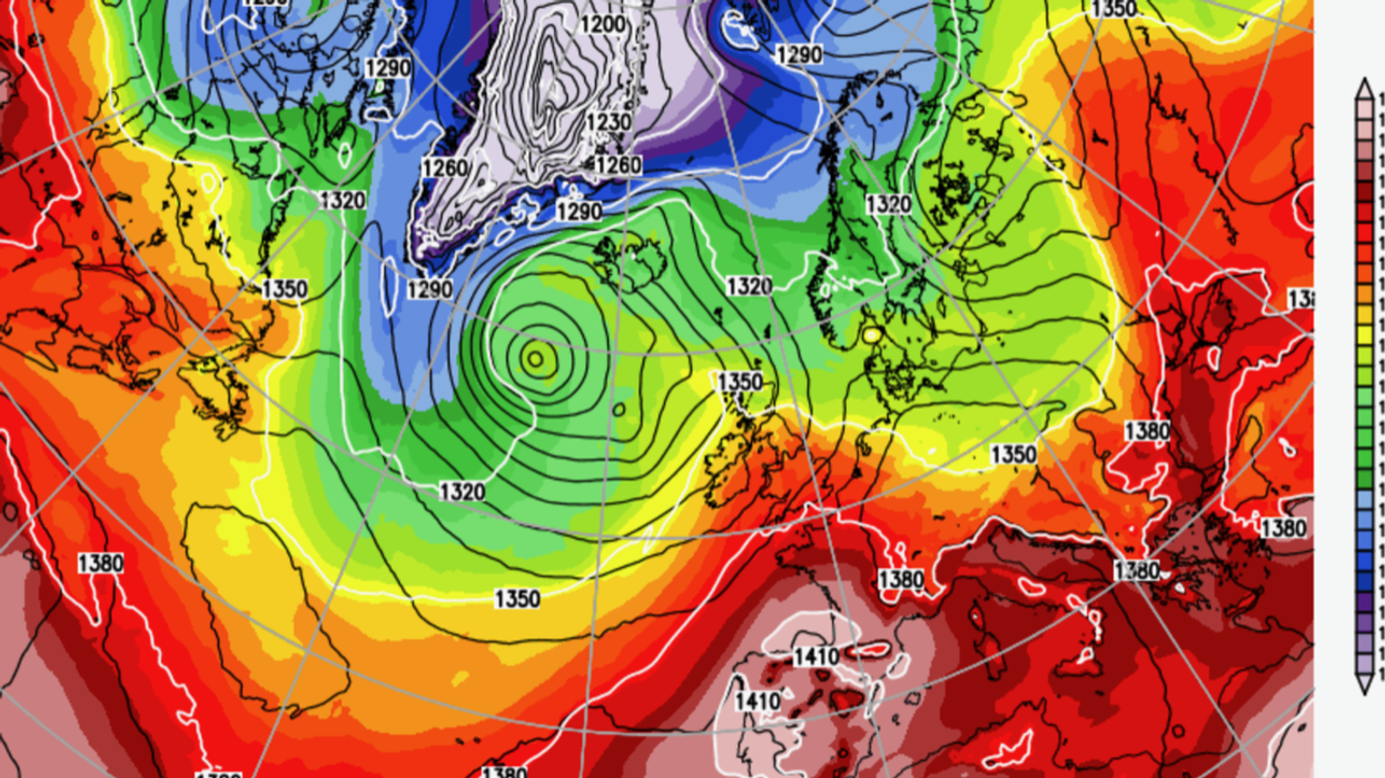
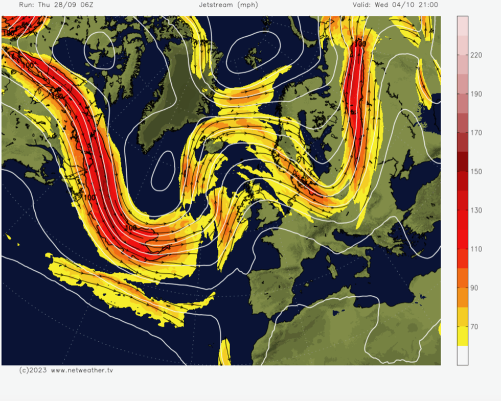
High pressure building in a loop of the jet stream formed by the storm will plunge Britain into an autumn steam bath.
However, unusual warmth, particularly in ocean waters surrounding the UK will open the gates to vicious autumn storms, experts warn.
WATCH: Met Office latest update
Exacta Weather’s James Madden said: “We could see a mixed theme of mild and unsettled weather during October with significant areas of low pressure posing a significant threat to the British Isles.
“There is the risk of at least one or two major stormy periods and at least one named ex-hurricane to hit our shores next month.
“If this does prove to be the case, then the current warm waters and sea surface temperatures surrounding the UK will only contribute to the force of these features as they hit Britain.”
Deceptively strong gusts fuelled by tropical waters could pose a threat to trees and buildings, he warned.
He said: “We could see much more damage and exceptionally stronger winds than we normally would from such a feature.”
In the meantime, Britons are getting t-shirts and sun cream ready for a promised 10-day Indian summer.
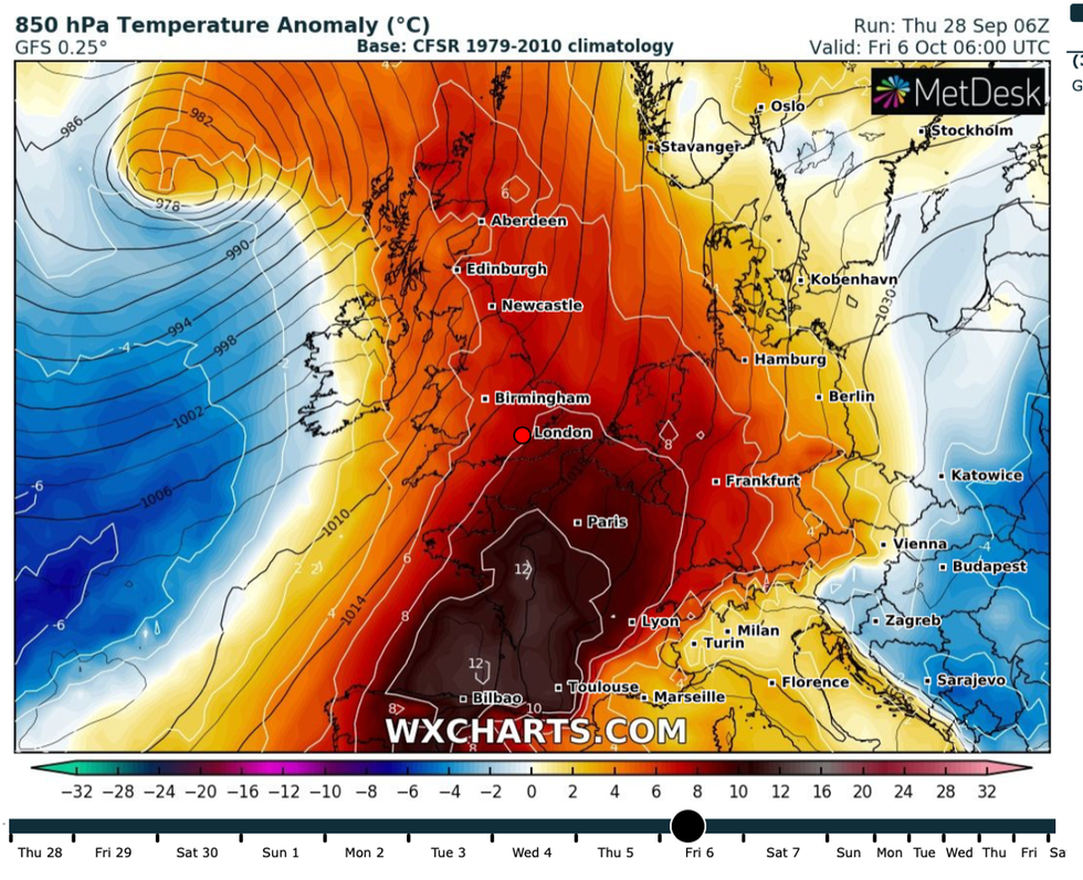
High pressure building in the wake of Storm Agnes this week will draw a plume of warm air up from the Continent.
Temperatures will remain well above-average possibly into the middle of the month, according to experts.

High pressure builds in the loop of the jet stream
|NETWEATHER
Jim Dale, meteorologist for British Weather Services, said: “Warmer weather is about to set in and we could see 23C in parts of the country in the next week.
“There is a lot of very pleasant weather on the way, and this is in part thanks to Storm Agnes which after moving through will allow high pressure to build and warm air to come up from the south.
“The warmer weather could hold out for the next 10 to 12 days, and because we will be into the start of October, it would now be accurate to call this an Indian Summer.”
A north-south split will bring the highest temperatures to the southeast of the country, he added.
He said: “The north will get the crumbs while the south and the south east gets the best of the cake.”
But Britons will have to wrap up before the warm weather arrives as chilly winds blow in from the west.

Unusual warmth, particularly in ocean waters surrounding the UK will open the gates to vicious autumn storms
|WX CHARTS
Low pressure circling the coast of Scotland will bring wet and windy outbursts through the start of the weekend, according to the Met Office.
Met Office meteorologist Alex Burkill said: “Friday night looks as though it might be a bit below average.
“If you are heading out first thing Saturday morning you will notice that chilly feel.
“We have some further wet weather pushing in from the west on later Saturday and into Sunday all due to an area of low pressure to the northwest of the UK.”
Warmer weather should set in after the middle of next week, although early predictions of heat should be taken ‘with a pinch of salt’, he added.
He said: “If we skip forward to Thursday the jet stream should have pushed a bit further north and high pressure is building across Europe and that is likely to dominate our weather, particularly across the east and the southeast, so it could turn pretty settled or even warmer here.
“But there is quite a bit of uncertainty about what is going to happen particularly as we go through later next week.”


