


Spring is about to be put back on hold by wind, rain and thunderstorms sweeping in from the Bay of Biscay.
Britain’s burst of sunshine will to give way to a week of foul weather as temperatures tumble this weekend.
High pressure, the driver of warm, settled weather, will be kicked out by a cyclonic storm heading in from France.
Britons should make the most of the hottest day of the year on Saturday before the glorious spring sunshine vanishes.
Met Office meteorologist Alex Burkill said: “On Saturday, we are likely to see the highest temperatures this week and for most of us it is going to be another fine day, and temperatures will be even higher at 25C or 26C.
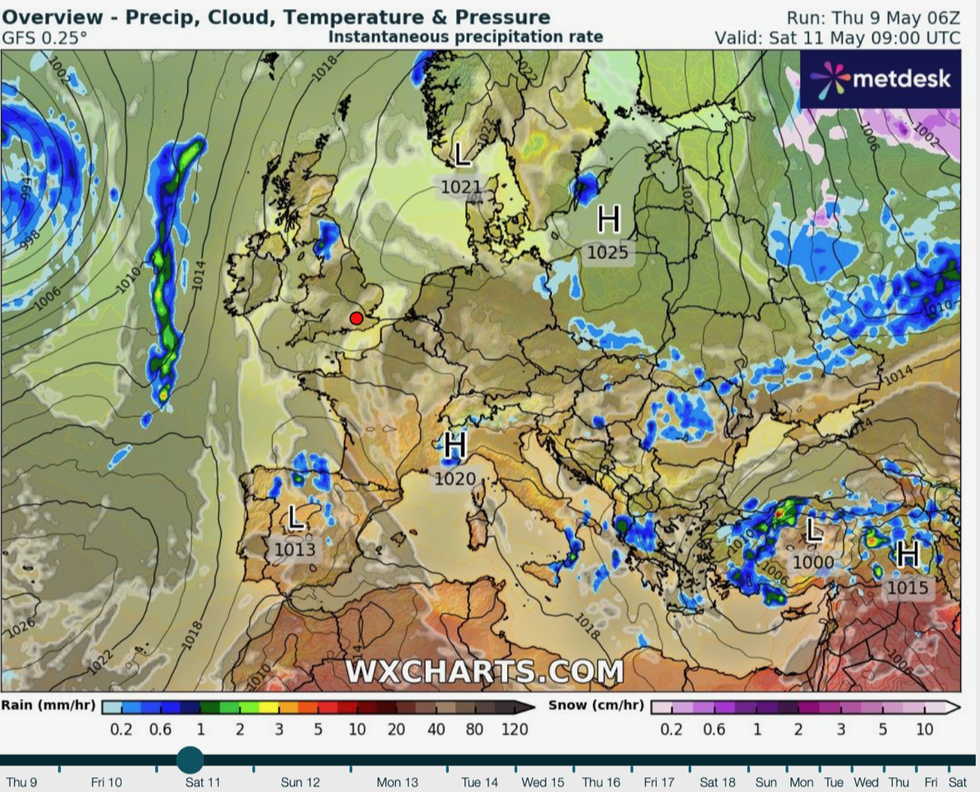
“Monday is when we are really going to see a change coming through, it looks like we will see an area of low pressure bringing wet weather across many parts of the country and we are going to have some strong winds that could cause some localised issues.
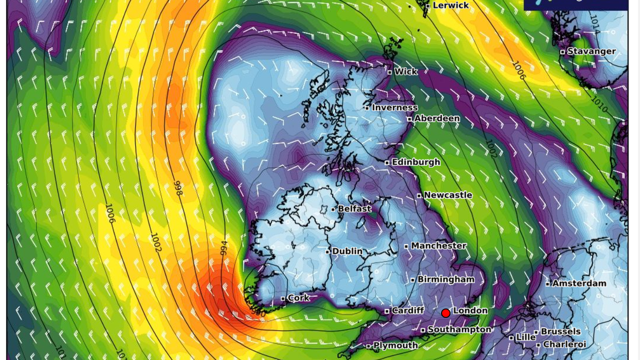
Low pressure sweeps in from the Bay of Biscay
|WX CHARTS
“Unfortunately, if it is dry weather that you are a fan of, pressure charts indicate that significantly lower than average pressure will dominate the picture as we go through next week across much of the UK.”
The spring sunshine will peak on Saturday although parts of the country could see the odd ‘hefty’ shower, he warned.
Although temperatures after the weekend will hover above average for the time of year, it will feel cooler in the wind and rain, he added.
He said: “A very wet spell is coming through, and the models are in fair agreement that it is going to be western parts that will see the highest totals.
“If we look at the week as a whole, temperatures are going to be a little bit above average, though not necessarily feeling always it if it is going to be a bit wet at times.
“It will be an unsettled spell as we go through the bulk of next week, with low pressure firmly dominating.”
Britain’s fine weather has been driven by an ‘anticyclonic’ high stretching from the south bringing clear skies and southerly winds.
This pressure system will be nudged eastwards through the start of next week by low pressure from the south.
Temperatures will be given a downwards shove by easterly winds along coastal regions, forecasters warn.
Jim Dale, meteorologist for British Weather Services and co-author of ‘Surviving Extreme Weather’, said: “We are going to pick up a bit of an easterly, and after this weekend which is when we are likely to see the highest temperatures as low pressure moves in from the Bay of Biscay.
“This will spell the end of the high pressure for the moment, and we go back to the ongoing risk of thundery showers.
“The warm and settled weather is not going to last, because after the weekend we go back into an unsettled regime with more in the way of rain and the chance of wind.”
In the meantime, sultry temperatures will bring tropical nights with thermometers to peak this weekend.
Exacta Weather forecaster James Madden added: “Saturday evening will bring an exceptionally warm evening for many, and temperatures will struggle to drop below 14C or 15C for many, and this will lay the foundations for an exceptionally warm to hot day on Sunday.
“Unfortunately, heading into next week, we have at least 'temporarily' low pressure influencing our weather pattern bringing unsettled weather and thundery downpours with relatively mild to normal temperatures.”