


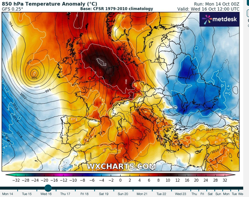
Britain’s icy chill is about to give way to a 70F Indian Summer thanks to an African plume charged with the ‘ashes’ of an Atlantic hurricane.
Temperatures across the country will rocket from Wednesday as warm air from the tropics sweeps across the Continent.
The balmy blast will be charged with the remains of Hurricane Leslie which withered in the Atlantic last week, and possibly a trace of Hurricane Milton.
Although hurricanes never directly hit the UK, their dying embers carried on the jet stream can influence the weather.
Jim Dale, meteorologist for British Weather Services and social commentator, said: “It is going to turn warmer this week as air arrives originating from Africa, and this could also contain the ashes of Hurricane Leslie and perhaps a trace of Hurricane Milton.
“Temperatures will peak around mid-week, and there will be a brief spell of T-shirt weather, particularly to the southeast and the east of the country.
 Warmer than average weather will strike Britain | WX CHARTS
“It is going to feel very different from what we have had over the past week or so.”
This week’s warm spell can be called an Indian Summer – arriving during the month of October after the first frost of the season.
The term comes from eighteenth century North America and is used to describe a period of unusually warm weather late in the year.
Warm weather this week will also be boosted by high pressure, the driver of summer sunshine largely absent the past few months.
Dale said: “We can call the upcoming warm weather an Indian Summer, and it will arrive wrapped around high pressure.
“There will be a period of changeable weather quite quickly afterwards before the warmth returns.”
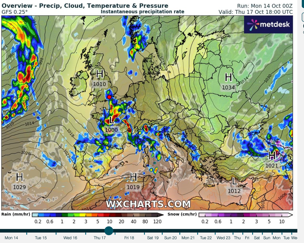
High pressure builds over Britain
|WX CHARTS
The warm weather will, however, fizzle quickly as low pressure brings wind and rain in from the west.
Temperatures will fall as the UK is plunged back into an autumnal wet and windy chill, experts warn.
Exacta Weather’s James Madden said: “From Friday, or perhaps sooner, we will see the influence of a major area of low pressure from the north of the country.
“Many northern parts are likely to become temporarily very unsettled during this period, and also temporarily cooler and unsettled in other parts of the country.
“But in the meantime, high pressure will rise towards the start of this week allowing much warmer conditions for the time of the year.
“Temperatures could well rise higher than the October average of 14C and even higher than 20C or into the low 20Cs, in the warmest spots.”
Government forecasters agree the warmth will be short-lived with the weekend ushering a more autumnal picture.
A Met Office spokesman said: “It will be unsettled on Wednesday with some heavy rain at times.
“It becomes drier and brighter on Thursday but turns wet and windy from the west on Friday, and milder than of late.”