


Britain’s early autumn chill may be a warning of things to come with the nation facing a freakishly cold start to winter.
The weather will be put through the mixer by global weather events, including warming and cooling of the Pacific – El Nino followed by La Nina– and pressure swings across the Atlantic.
Long-range predictions for unusually high pressure across the country could spell a colder start to the season, experts say.
Dr Todd Crawford, meteorologist for Atmospheric G2 and The Weather Company, said: “The greatest threat for cold appears to be earlier in the winter.
 Temperatures dip at the end of the month | WX CHARTS
“Weak and moderate La-Nina winters are generally colder than the long-term temperature trendline across western Europe, so we do expect some colder spells there this winter, especially early.”
Storms in the tropics, however, and an El-Nino Pacific warming followed by a La-Nina cooling are giving experts a forecasting headache.
The past year has brought one of the strongest El Ninos recorded which, with its La-Nina counterpart, can affect European winters.
Pressure patterns across the North Atlantic – the so-called North Atlantic Oscillation (NOA) – can also drive colder winters.
Meteorological models and forecasting ‘analogues’, both used to predict weather, struggle to agree on how these ingredients will combine to influence the season.
Dr Crawford said: “Analogues and models both depict anomalous high pressure across UK and parts of western Europe, but they differ significantly in the position of the high pressure.
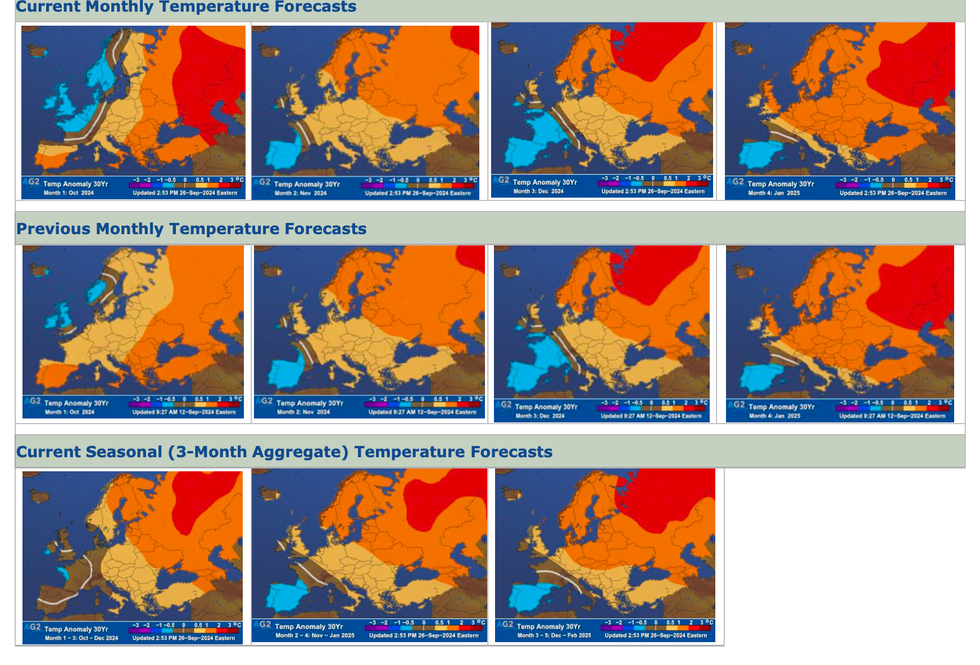
Monthly temperatures predictions
|ATMOSPHERIC G2
“Models have it farther south and analogues farther north, with the former being generally warmer and the latter being colder since more of western Europe is exposed to cold continental easterlies.
“The greatest threat for cold appears to be earlier in the winter, with analogues and models depicting a stronger positive NAO signal late winter with a warmer view.”
Weather experts are, however, keen to warn seasonal outlooks rarely paint a confident long-range picture.
Tropical hurricanes, such as Milton and Helene, dumping their remnants in the jet stream can jolt the UK’s weather.
Unexpected changes in pressure over Europe and the Atlantic can also bring last-minute surprises.
This week will see high- and low-pressure systems battling to bring an icy weekend followed by the threat of an unsettled run into mid-month.
Met Office meteorologist Alex Deakin said: “Into the weekend, it is a messy old picture with the pressure and the jet stream all over the place, and the jet stream split in two so we have two tracks of low-pressure systems.
“As we go into next week, we have a battle set up with stubborn high pressure over the continent and low-pressure systems trying to get in from the northwest.
“It looks like the high will dominate for the early part of next week, but how long it lasts is the big question.
“South-westerly winds will bring milder air from the Atlantic, but also cloud and outbreaks of rain.”
Scotland and northern Britain will take the hit of an early cold snap, as bitter winds pour in from the Arctic.
Jim Dale, meteorologist for British Weather Services and social commentator, said: “It is fair enough to say there will be some colder interludes, and it will be the north of the country that will bear the brunt.
“El Nino and La Nina have a peripheral effect on the weather in the UK.”