
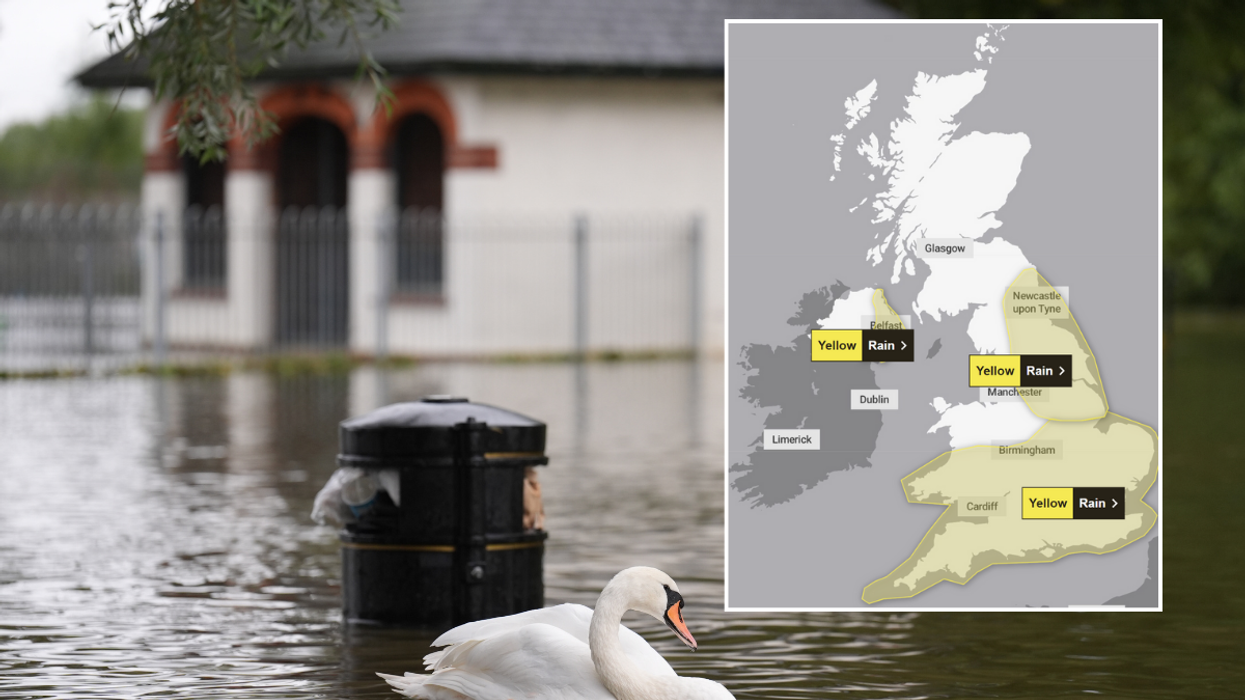


The Met Office has issued three yellow rain warnings for Thursday and Friday, covering large swathes of England, Wales, and Northern Ireland.
The warnings, which came into effect early Thursday morning, predict heavy downpours and potential thunderstorms across the affected regions.
Forecasters warn of possible flooding, travel disruption, and power cuts as nearly three inches of rain could fall over several hours in the worst-affected areas.
The Environment Agency has also issued 28 flood warnings across England, indicating that flooding is expected in these locations.
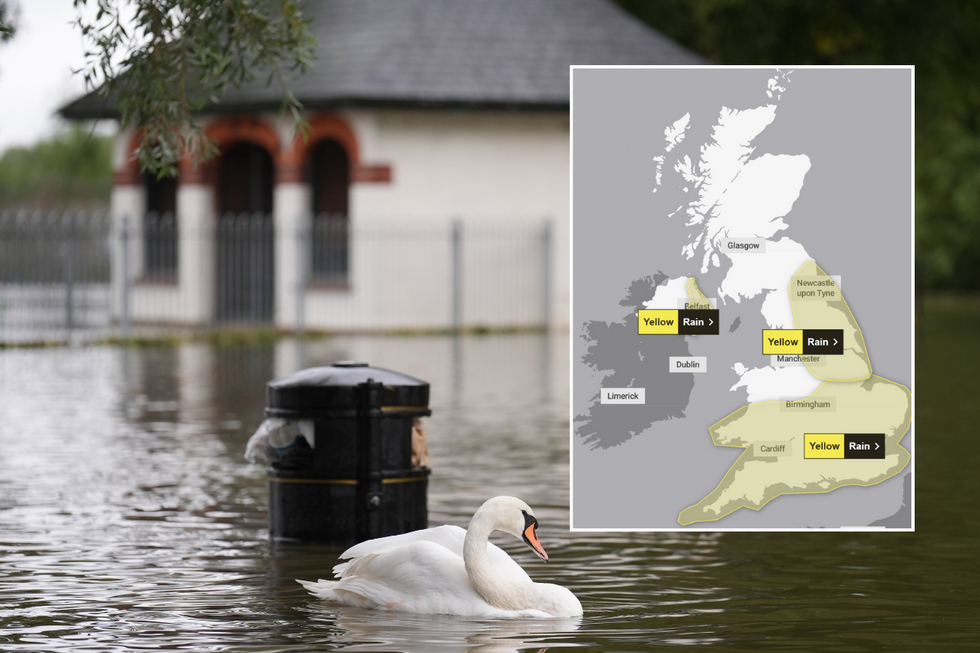
Flooding hit Wellingborough in Northamptonshire
|PA/Met Office
This latest deluge follows Monday's downpours, which left parts of Britain underwater with homes flooded and travel severely disrupted.
The Met Office warns that most areas within the warning zones are likely to see 20-30mm of rain, with some locations potentially experiencing 50-70mm.
The highest rainfall totals are expected across the Pennines and North York Moors, where 80-100mm could accumulate on Thursday.
Met Office Chief Meteorologist Paul Gundersen said: "With the rain today and tomorrow potentially falling on already saturated ground a number of warnings for rain have been issued outlining the increased risks for potential impacts."
The warnings indicate a slight chance of power cuts, flooding of homes and businesses, and the possibility of some communities becoming cut off by flooded roads.
The Met Office has highlighted specific areas at highest risk of severe rainfall.
LATEST DEVELOPMENTS
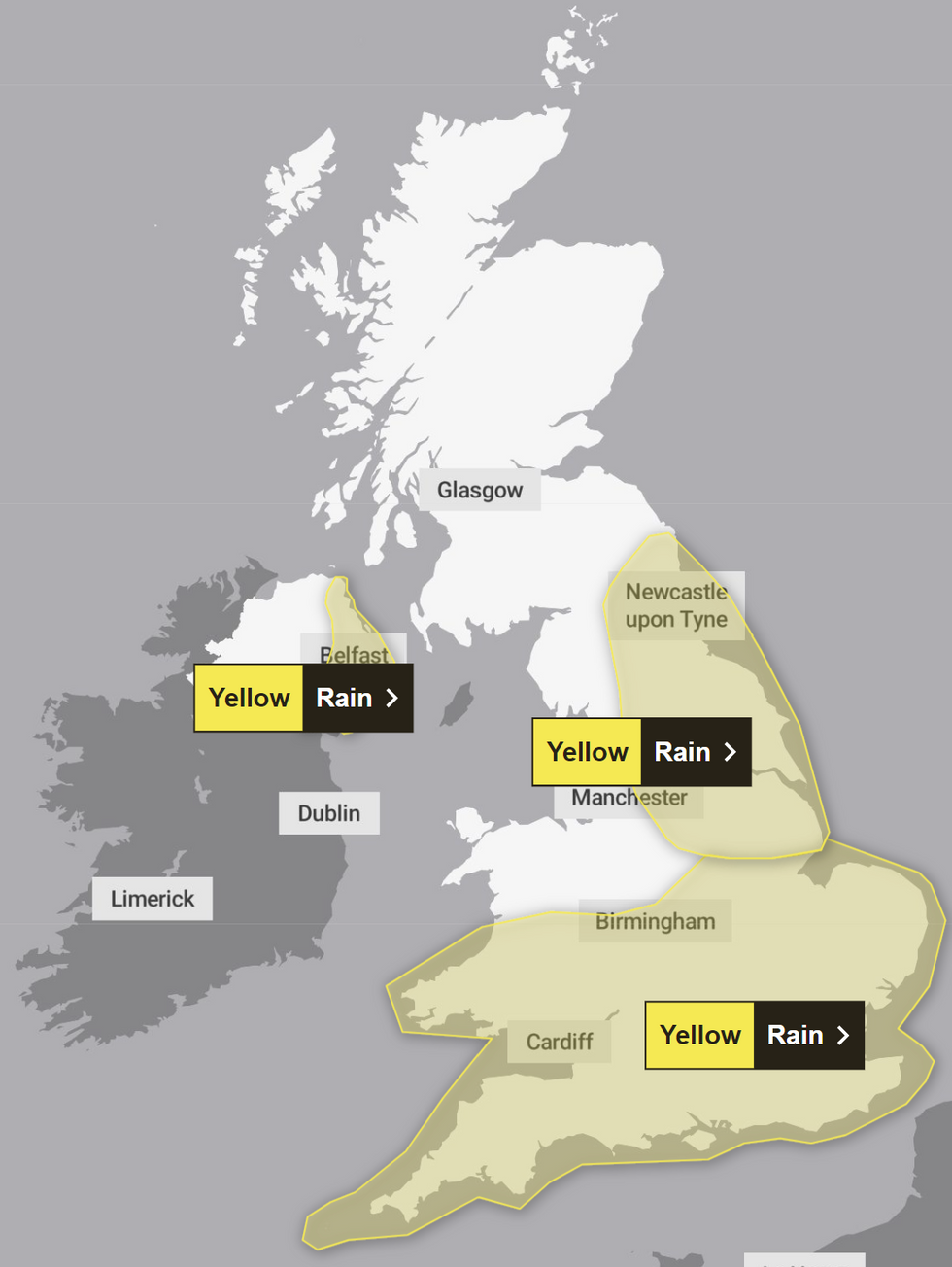
Weather warnings are in place
|Met Office
The Pennines and North York Moors could see up to 100mm of rain accumulate over Thursday.
In southern England and Wales, forecasters warn of potential thunderstorms and strong winds later in the day.
The Environment Agency has issued 29 flood warnings for "expected" flooding and 65 alerts for "possible" flooding, primarily across central and southern England.
Some communities could be cut off by flooded roads, with fast-flowing or deep floodwater posing a potential "danger to life."
There will be further outbreaks of rain in central and southern areas of the UK on Friday morning, the Met Office said. The rain is expected to clear during Friday leaving conditions much colder on Saturday.
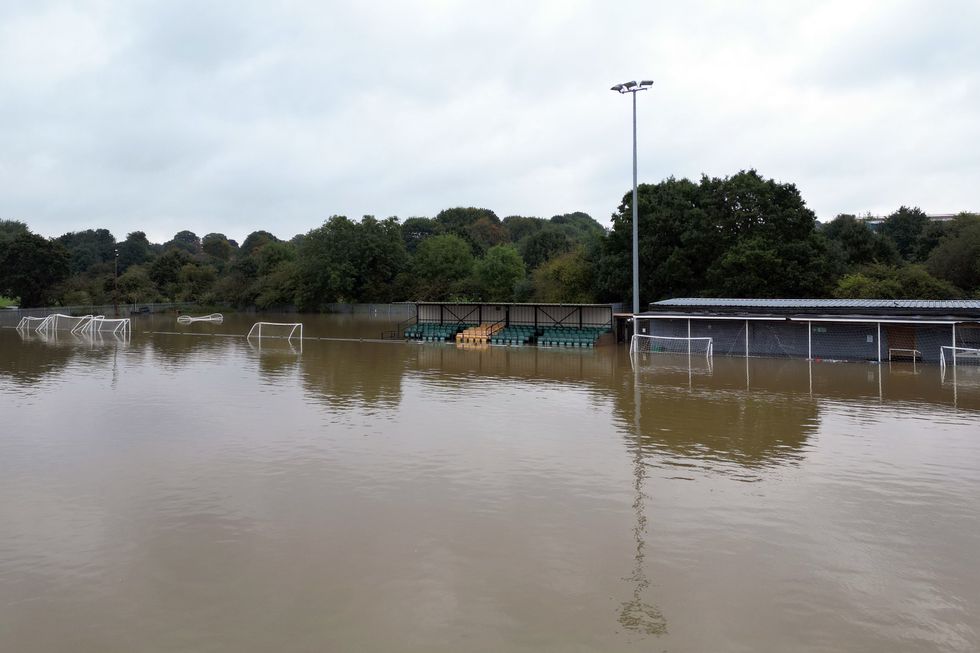
Floodwater submerges Spencer Football Club in Northampton
|PA
The weekend forecast indicates a shift in weather patterns. The Environment Agency has 28 flood warnings in place across England, meaning flooding is expected.
According to Met Office Deputy Chief Meteorologist Brent Walker: "Things will be turning decidedly cooler into the weekend, with frost likely for much of the UK overnight on Friday and a more autumnal feel to daytime temperatures."
Saturday is expected to start drier, but frequent showers are predicted in western Scotland and Northern Ireland.
The respite may be short-lived, however, as strong winds and heavy rain are forecast to move in on Sunday night into Monday.
This cooler trend marks a change from the recent wet weather, signalling the arrival of more autumnal conditions across the UK.