


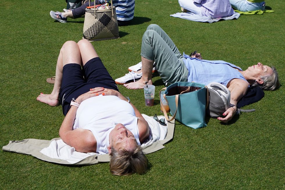
Britons may be given a brief glimmer of sunshine this weekend before the gates once again open to the misery of the Atlantic.
While some forecasters cling to a fading hope of any summer this year, others have submitted to a ‘pessimistic’ outlook.
Weeks of rain and sub-par temperatures will give way on Sunday to a 23C burst of joy for the England-Spain game.
But most weather forecasting models then predict a return to cloudy skies, grim temperatures and rain.
Britain will finally get some sunshine this weekend
|PA
Met Office meteorologist Aidan McGivern said: “Heading into the weekend, higher pressure is to the north and extending a ridge over the UK.
“It is still relatively cool for the time of year, several degrees below average, on Sunday it is warming up, 23C which is not far from average for the time of year.
“Later in the month we could see a ridge of high pressure building, but it is most likely that we see higher pressure to the southwest, low pressure over the UK, and a south-shifted jet stream.
“As meteorologists, we would suggest following the more pessimistic scenario – lower pressure and more showery conditions.”
Britain’s weather will this weekend fall to the mercy of another bonkers meteorological quirk.
A ‘trapped vortex’ will ‘suck’ air from ground level into the atmosphere driving heavy downpours.
LATEST DEVELOPMENTS:
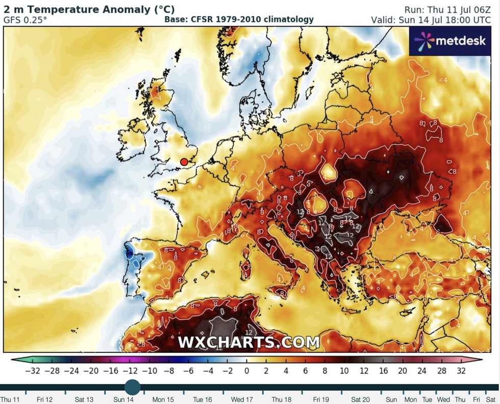
Temperatures little bit on the up
|WXCharts
The jet stream will split into two branches – one to the north and another spiralling over the UK – keeping Britain in the washing machine.
Mr McGivern said: “The jet stream is pushing even further north than thought previously, and this amplification allows high pressure not to topple over the UK but build to the north of the UK.
“So, with the jet stream to the north and unable to move another branch out of the way, we end up with a trapped vortex.
“This means circulation in the upper winds sitting over the UK and an upper area of low pressure over the weekend that is unable to move for a couple of days and this allows another low pressure to move in for the start of next week and continuing the theme of the summer so far.”
The sun should, though, poke through the clouds long enough on Sunday for Football fans to enjoy the game.
Scotland and northern England will be most at risk of showers while the south gets the best of the weather.
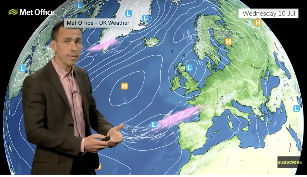
Met Office’s Aidan McGivern describes ’trapped vortex'
|Met Office
Temperatures will nudge into the low-20Cs which while generally unimpressive for mid-July, will bring welcome relief from the chill.
Jim Dale, meteorologist for British Weather Services and social commentator, said: “There will be some very pleasant weather around at the weekend.
“We are not talking about very high temperatures, but a change in the jet stream could easily change the outlook.
“And this is the theme for the rest of the July because the season is not over yet, and there is still a chance that that summer may be rescued.”
Coral has optimistically slashed the odds to 5-4 from 3-1 on this summer ending as the hottest on record.
Spokesman John Hill said: “We are set to see a big change in the weather over the next couple of weeks, and with baking temperatures expected, we could still be in for a record-hot summer in the UK, as our odds suggest.”