


Storm-hit Britain faces another blast of wind and rain before a ‘tropical high’ fans the nation with balmy winds.
As swathes of the UK mop up from Storm Ashley, the Atlantic is firing up for another assault.
Low pressure – the driver of unsettled weather – is swirling round Britain ready to stir things up ahead of the weekend.
Then, waiting in the wings is the Azores High – an ‘anticyclonic’ high-pressure system from the tropics usually associated with summer heatwaves.
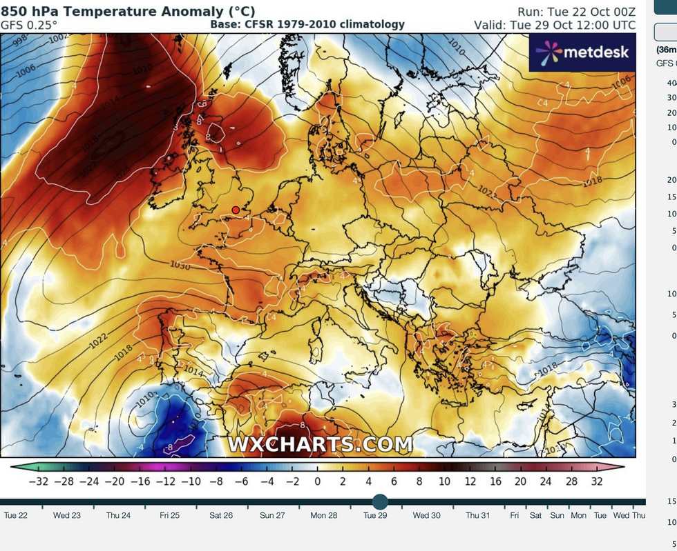
WX Charts Temperature anomaly map shows Britain could experience warmer weather
| WX ChartsWith late-October temperatures to rocket into the high-teens, Halloween trick-or-treaters could be wearing t-shirts rather than coats this year.
Jim Dale, meteorologist for British Weather Services and social commentator, said: “The Azores high looks like it will plant itself over Britain after this weekend, and this will bring calmer weather with temperatures in parts hitting 16C or 17C.
“We are expecting a welcome period of settled weather towards the end of the month to follow the stormy conditions so far this month.
“However, before that there is more unsettled stuff to come.”
LATEST DEVELOPMENTS: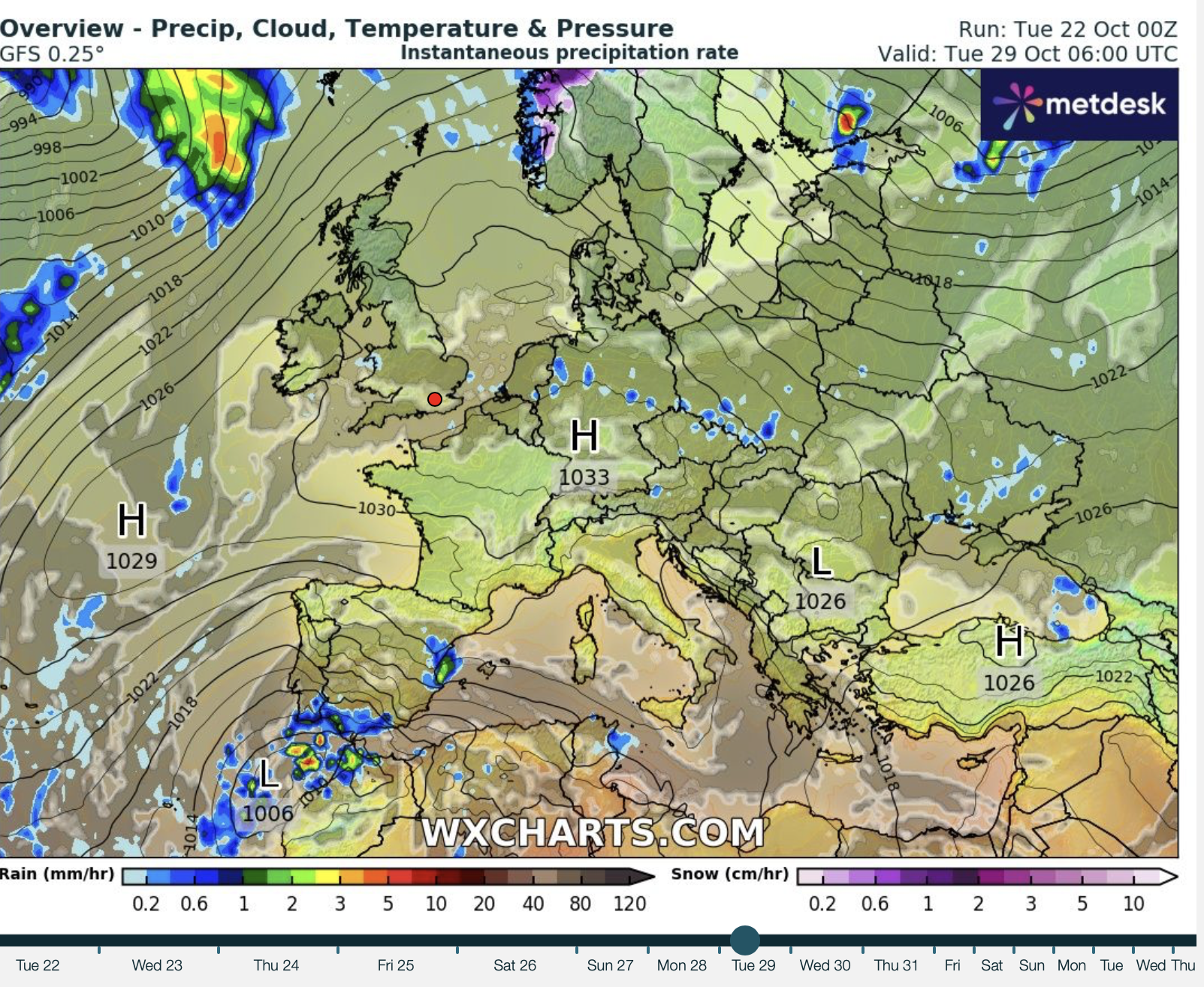
High pressure sweeps over the UK later this month
|WX Charts
Storm Ashley’s weekend hammering saw gusts of more than 80mph bring delays on roads and transport networks.
Further unsettled weather will hit at the end of the week into the weekend, before the weather settles.
Dale said: “We are going to keep the westerlies later this week and into the weekend, and although it does not look as bad as Ashley, there is more unsettled weather on the way.
“This starts to pick up on Thursday and into Friday, with low pressure in charge through the weekend.
“After that, we are looking at things settling down and bringing a calmer period of pleasant autumn weather.”
A brief window between storms will bring a milder spell of calm today and tomorrow before wind and rain returns.
Temperatures will fall this weekend as volatile weather conditions make their return, with northern regions in the firing line.
James Madden, forecaster for Exacta Weather, said: “From around Tuesday Thursday we will see an area of non-significant high pressure extending to give some temporary relief and quite warm daytime temperatures with some brighter or sunny spells and drier weather for many.
“We should see temperatures in the high teens for many in the best of the autumn sunshine, and possibly even 20C or higher could be reached in the south.
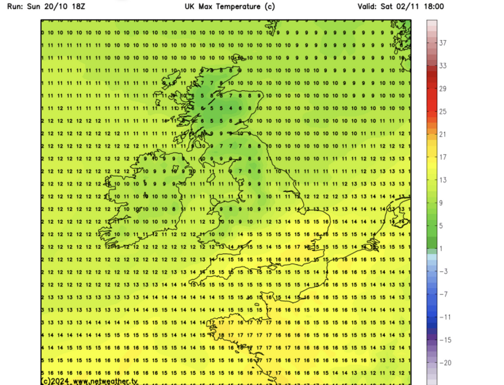
Early October temperatures in the high teens
|Netweather
“However, low pressure looks to return from Thursday, and this could bring some heavy showers and potentially gusty to strong winds.
“This will pave the way for much cooler to even colder conditions for the time of the year from the north as we head into next weekend.”
A Met Office spokesperson said: “A trend for high pressure will build close to the UK later in the weekend and beyond into early November.
“This should offer some longer drier spells of weather, with an increased chance of frost and fog, which could be slow to clear in places.”