


Temperatures across Britain are set to be "changeable" for the remainder of August with "unsettled" conditions forecast for the bank holiday weekend.
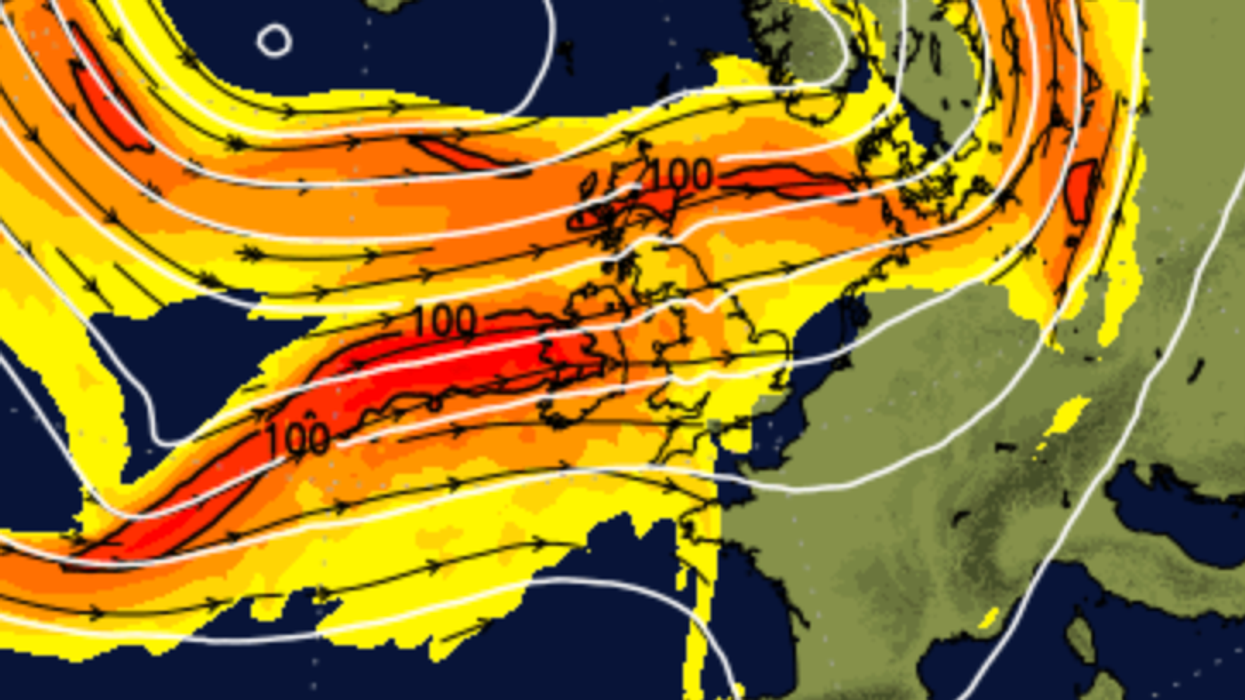
Weather experts say that "the Azores High" - which allows warm air to push north across Britain - will be "lurking" but "spells of rain" are likely.
While the remnants of a hurricane from Bermuda could also cause changes in weather across the UK.
Forecasters at NetWeather say the latest maps show a dry weekend with warm sunshine.
 Weather experts say that "the Azores High" - which allows warm air to push north across Britain - will be "lurking" but "spells of rain" are likely | Net Weather
However, this week’s warm air will fade away from the south east as fresher air takes hold from the Atlantic.
Next week is expected to be "changeable" with warm weather early on before fresher conditions strike.
The bank holiday could see showers from the west with some bright spells.
However, Hurricane Ernesto - which is heading to the Bermuda - could alter conditions.
LATEST DEVELOPMENTS:
NetWeather forecaster Jo Farrow said: "We will have to watch how the remnants of a hurricane from Bermuda shake up the forecast later next week.
"No signs of a return to the oppressive heat of last Monday but strong August sunshine should warm us by day, when it appears."
Farrow added that the Azores High "could extend into south west Britain and settle our weather down".
She said: "The following weekend will include a Bank Holiday Monday for parts of the UK.
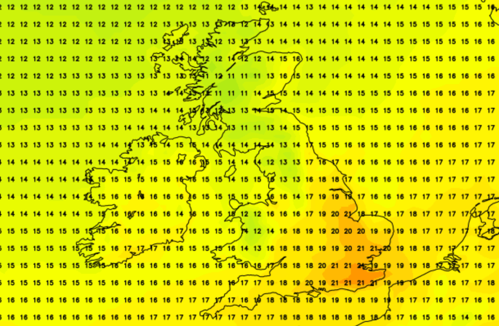
Next week is expected to be "changeable" with warm weather early on before fresher conditions strike
|Net Weather
"The main features in the outlook that far ahead are; a strong signal for this showery cooler westerly flow linked to low pressures away to the north, the Azores High which could extend into SW/S Britain and settle our weather down.
"That would allow higher daytime temperatures with more sunshine. Currently, the low pressure seems more dominant for Scotland and a better chance of fine weather in the south, but not always for exposed western coasts.
"One point of interest will be Ernesto, currently a hurricane heading for Bermuda on Saturday.
"This should reach Newfoundland early on Tuesday as a post-tropical hurricane and will then head across the North Atlantic, interacting with the jet stream and main synoptic setup for our Bank Holiday weather."