


Britons should brace themselves for more cold weather, as temperatures plummet to below freezing this week as a 500-mile icy chill sweeps its way across the nation.
New weather maps released by WX Charts show the chill beginning in the northeast, where the mercury will drop to -1C on Wednesday.
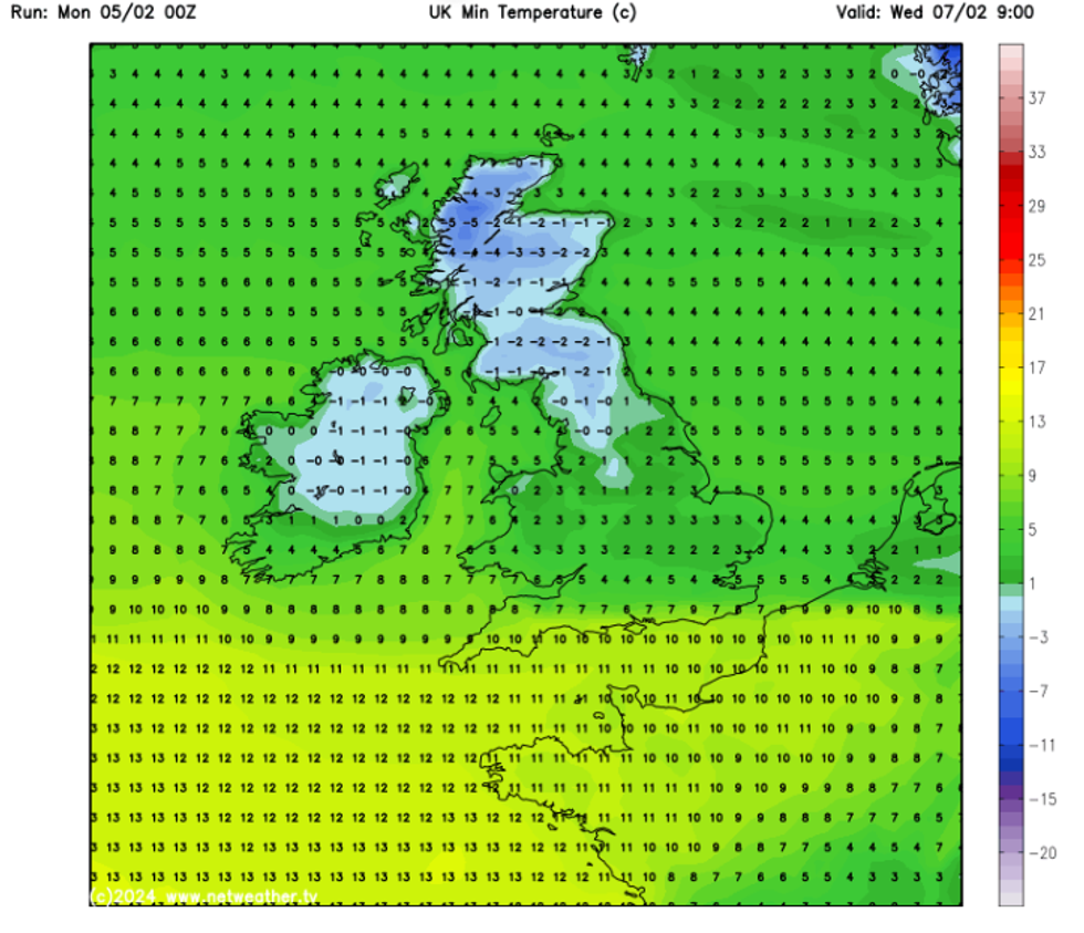
The low temperatures will extend across the UK, as maps show a huge 479-mile cold front expanding from Manchester up to the furthest tip of Scotland, where temperatures will plummet to -5C.
The Met Office has warned that as the week progresses, the cold air front established in the north will “extend to all parts through next weekend”.
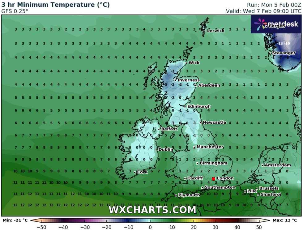
The temperature will plummet to -5C on Wednesday
|WXCharts
The forecaster said: “As it does so, there is a risk of some significant snowfall for parts of the UK, perhaps central areas most prone to this, but this aspect is very uncertain at this stage.
“Across the north cold throughout with snow showers tending to focus on northeastern areas while for the far south, the period may start off with some rain and near average temperatures before the cold air reaches here by the start of next week.
“Windy at times, especially so in some eastern areas where a notable wind chill is expected.
“Temperatures ranging from rather mild in the south at first, to cold, perhaps very cold in the north.”
WEATHER LATEST:
Charts from the Met Office suggest that the temperatures will not drop as low as -5C, but a cold chill is still to be expected across much of the UK.
The Met Office predicts that on Wednesday, parts of Scotland will see the mercury fall to -1C, whilst in Kendal, Lake District, temperatures of 0C are to be expected.
Netweather forecaster Nick Finnis predicts that after a mild bout of of weather this past week, in the next few days, winter will "bite back".
Britain saw its hottest January day ever, with a high of 19.6C recorded in Kinlochewe, in the Scottish Highlands.
Charts from Netweather also show an equally chilly front hitting the UK this week
|Netweather
While temperatures surged, parts of the UK were hotter than holiday hotspots such as Ibiza, Athens and Corfu where conditions peaked at 17C.
However, Finnis said that going into the week ahead, we can expect a chill to reappear as a cold air beginning in the north tries to push south.
He said: "By next Saturday, highs could be a good 10C or more colder as winter bites back later next week.
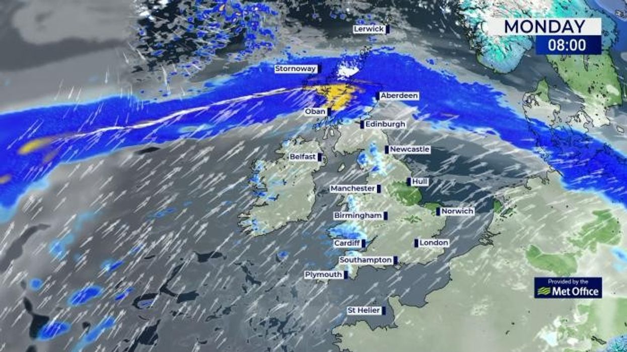
"After a mild start and mostly dry start to the coming week across England and Wales, it will turn increasingly unsettled across all parts by mid-week, with persistent heavy rain along a slow-moving cold front pestering western Scotland today and tomorrow moving southeast across most of the UK on Tuesday, followed by cooler conditions, cold in Scotland.
"Then, later in the week and into next weekend, a battleground looks to develop across the UK between cold arctic air trying to push down from the north and mild air trying to spread north.
"Usually, the cold air tends to win out straight away, but a low moving east off the Atlantic somewhere over southern Britain looks to try to push mild air back in across the south.
"But as the low clears, the cold arctic air looks to win out by next weekend. There could be some snow during this transition to cold air."