


Britain is in the cross-over of two weather fronts, with powerful winds from an Arctic blasts the country today before the snow clears and makes way for a brutal 50mph storm this weekend.Temporary blizzard-like conditions could cause havoc across the UK, as mighty north-westerly gales disperse the snow further.


An additional 5-10cm of snow is likely to fall, with up to 40cm expected to accumulate in northern parts of Scotland.
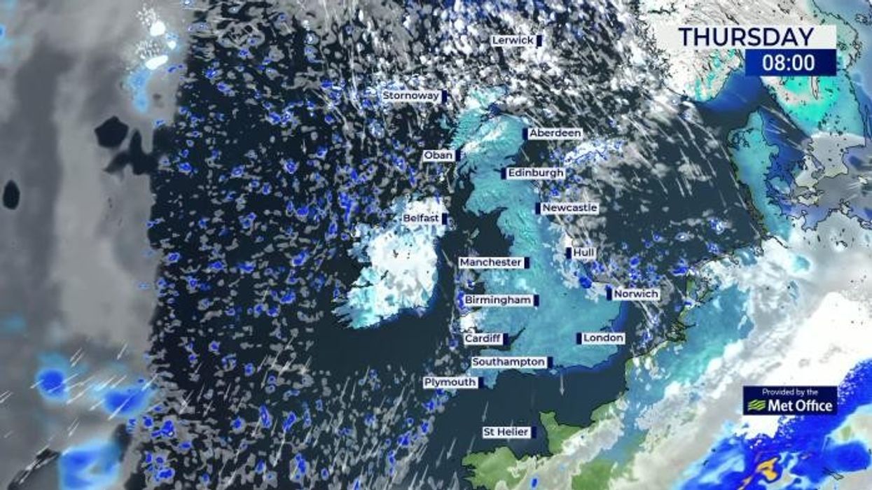
The Met Office has issued six separate weather warnings up and down the country, as wintery conditions continue to sweep across the UK, bringing with them heaps of disruption.
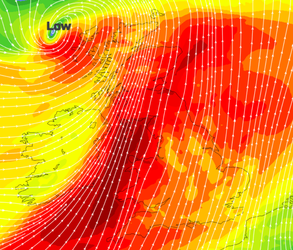
Powerful wind gusts of up to 70mph moving northwesterly hit the UK
|Netweather
In Scotland, the weather office has issued two orange snow warnings, cautioning that regular heavy snow showers will disturb travel across the area.
The pair of rare alerts began at 3.00pm yesterday and are in place until 6.00pm today. They cover the Highlands, the Orkney Islands and the Shetland Islands.
“We're going to see more snow showers there. But also some pretty brisk winds, so there will be a lot of blowing snow," Met Office forecaster Simon Partridge said.
“Travel in particular will be quite difficult in that part of the world.”
Met Office Chief Meteorologist Jason Kelly added: “With deep snow already lying on the ground for many in the northern half of the UK, we’re going to see a significant topping up of totals over the next couple of days, especially for those in the north of Scotland.
“Within the Amber warning area, an additional 15-20cm of snow is possible in a few locations. Strengthening northwesterly winds will also cause some lying snow to drift, potentially bringing some additional hazards, such as temporary blizzard conditions.”
WEATHER LATEST:
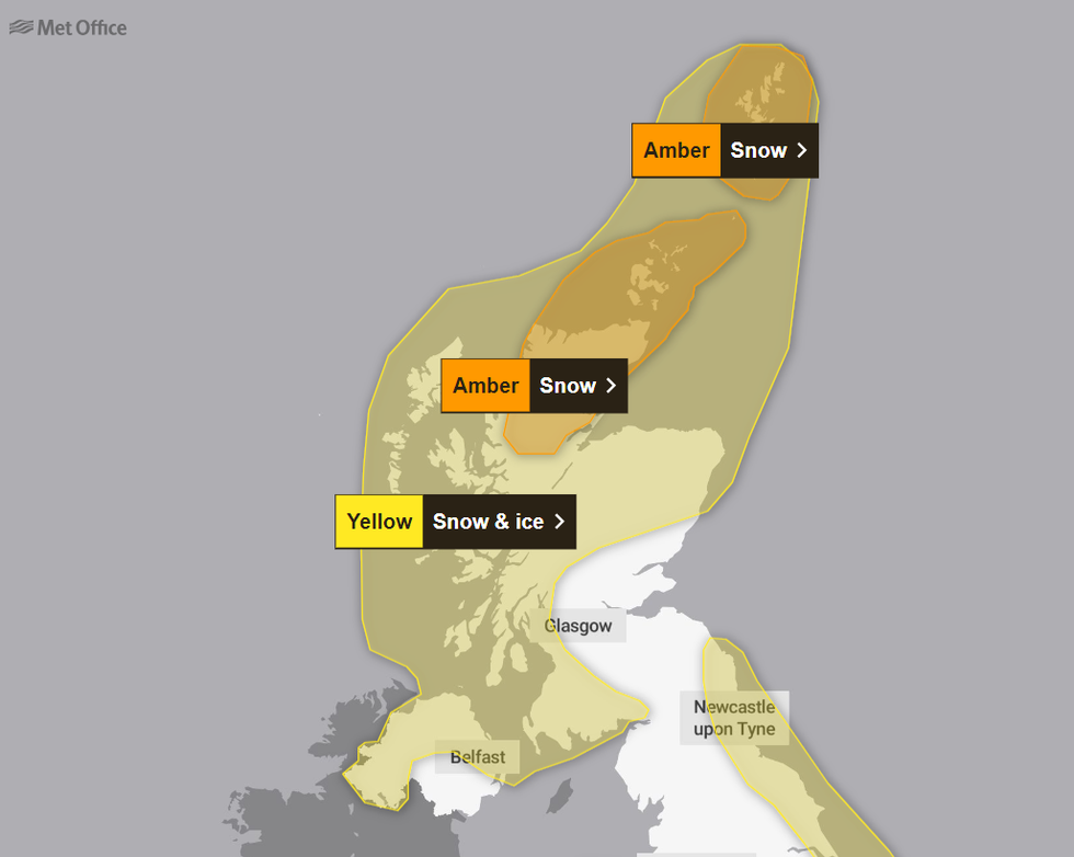
The orange warnings in place today
|The Met Office
Delays on roads are likely and some vehicles and passengers could be stranded due to the wintery conditions, the Met Office has warned.
They also cautioned that as the blizzard sweeps over the UK, there is a “good chance that some rural communities could become cut off” and power cuts could occur.
The Met Office has cautioned drivers not to take to the roads during these wintery conditions. If they must, they must use dipped headlights, maintain a steady speed and keep distance from other vehicles.
Yellow snow and ice warnings are also in place across the UK, ranging from Land’s End to John O’Groats.
The alerts caution Britons to be wary of treacherous conditions that could lead to injury, as ice sweeps across the country.
In the runup to the weekend, the Met Office said: “Cold Arctic air remains dominant over the UK, with snow and ice likely to continue ahead of the weekend for many in the northern half of the country, including Scotland, Northern Ireland, parts of northwest and southwest England, and north and west Wales.”
Describing the arctic cold blast sweeping the UK, Net Weather’s Jo Farrow said: “Northern Scotland remains the focus for snow showers with a noticeable wind chill. Wintry showers will also reach western Scotland, Northern Ireland, Wales, Merseyside and Lancashire, areas exposed to the NNW wind.”
The wind is expected to continue into the weekend as gales of up to 60 to 70mph are expected, with Farrow cautioning that “it will be windy everywhere”.
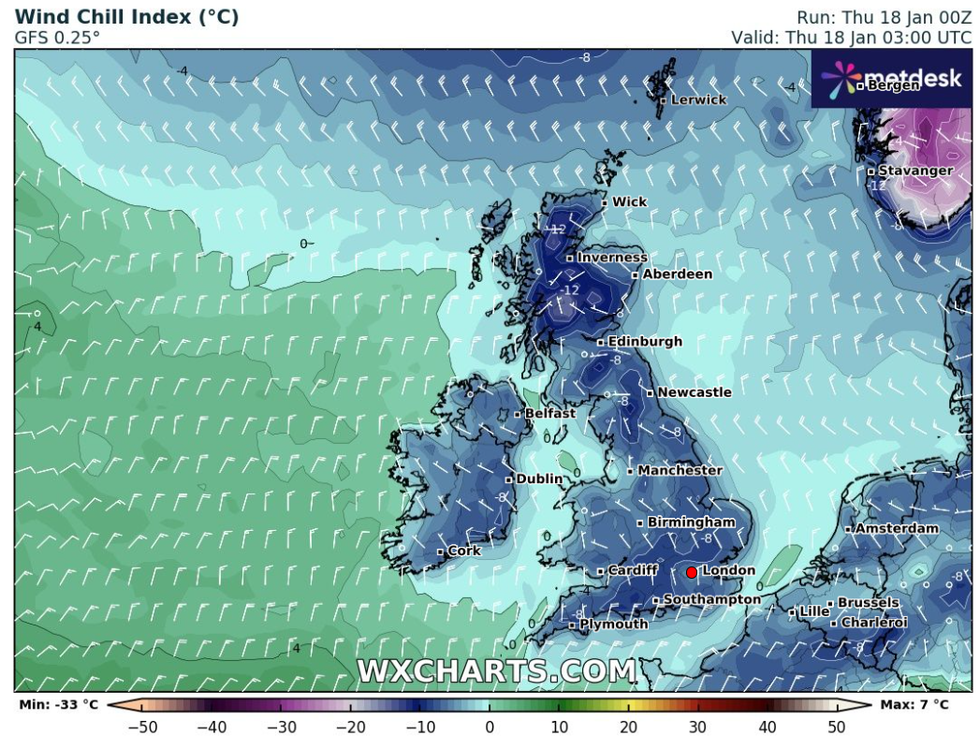
Frosty conditions sweep over the UK, as an arctic chill in the minus figures pummel the country
|WX Charts
From Friday, the freezing arctic blast will be replaced with milder Atlantic air from the west.
However, the wind, whilst warmer, is expected to stay. “While temperatures will increase from the markedly low figures of recent days, this change in airmass will also introduce the likelihood of a return to wet and windy weather for most through the weekend,” the Met Office said.
Farrow explained: “The main difference this weekend will be how the air feels and that it will be windy everywhere. Daytime temperatures should be around 4 to 8 Celsius although it seems bold to say mild with the wind and for those seeing rain. The air will be quite different from this Arctic flow so it will feel milder, ‘not as cold’.”
On Sunday, a yellow “danger to life” wind alert will come into effect for much of the UK.
Disruption is likely and damage to buildings could occur because of the powerful winds, the Met Office has cautioned.
Inland, winds of 50-60mph are expected, whilst on the coast, highs of up to 70mph could batter exposed locations.
"This change will be accompanied by very strong, possibly disruptive winds gusting up 60-70mph in places. Spells of heavy rain could bring some renewed areas of flooding,” BBC Weather's Chris Fawkes said.