


Britons are being warned to brace for more heavy snow and temperatures to plummet to -6C in February as a cold snap swoops in from Greenland.
Long-range weather maps suggest snow could fall from February 2 as temperatures drop below zero and heavy rain strikes.
Forecasters predict that "some major snow and cold weather" will return from February 2 and 3.
Heavy snow looks set to hit swathes of Scotland and north east England on February 5.
 Snow is set to hit part of Britain in February as a cold snap returns | WXCHARTS
More flurries are expected to blanket Manchester, south east England and Northern Ireland on February 5.
ExactaWeather's James Madden suggests a "strong Greenland blocking pattern" could bring in the cold snap.
"Our projections are consistently showing up the potential for another temporary snow event towards the end of the working week and into next weekend that could bring further heavy snow to the north/ Scotland, and potentially to parts of northern England, Wales and Northern Ireland/Ireland within this period," he told The Daily Star.
"This is only likely to be a passing snow event for later next week and not the return of the cold and snow proper.
LATEST DEVELOPMENTS:
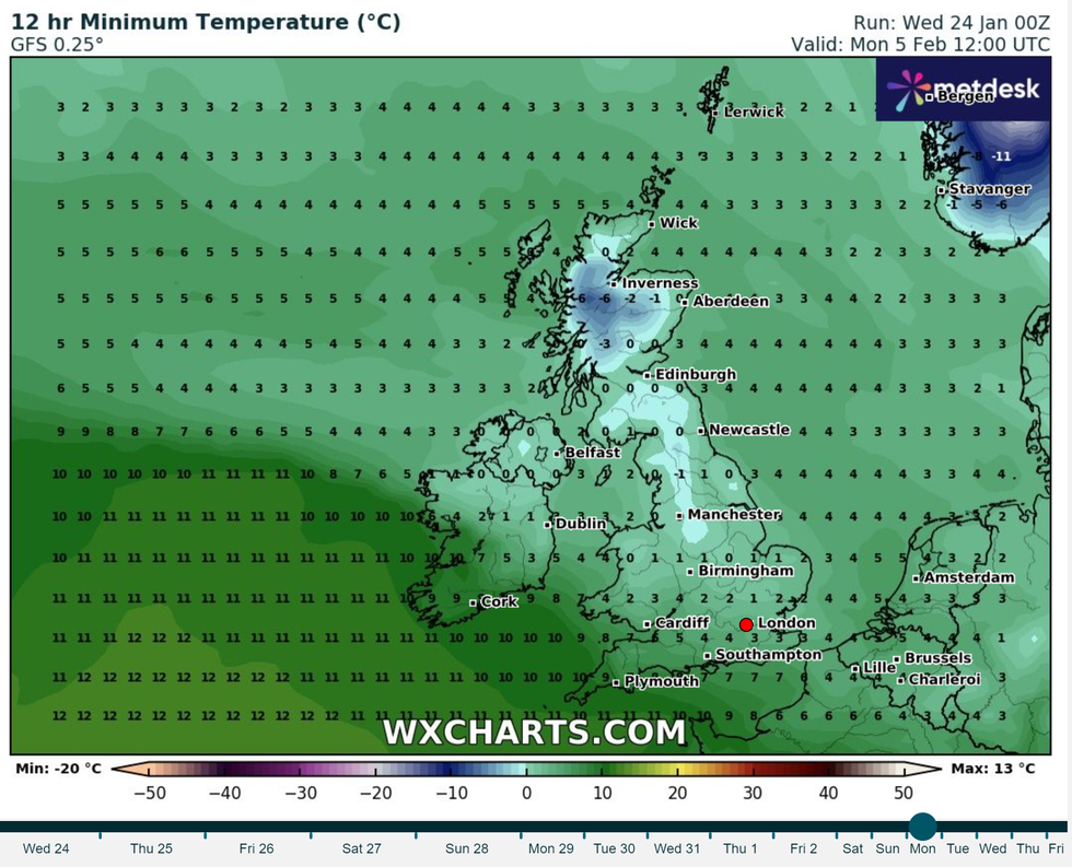
Britons are being warned to brace for more heavy snow and temperatures to plummet to -6C in February
|WXCHARTS
"However, we do expect some major snow and cold weather to start gaining significant ground to return for in and around February 2 and 3, possibly a little earlier or later depending on a small standard deviation for any timeline changes between now and then.
"A strong Greenland blocking pattern is also something that we have repeatedly and consistently insisted would happen for February and from as early as September, due to an earlier and now confirmed sudden stratospheric warming (SSW) event."
The Met Office has predicted more wintry conditions in mid-February.
A spokesperson said: "Into early February there is an increased likelihood of high pressure having greater influence on UK weather patterns.
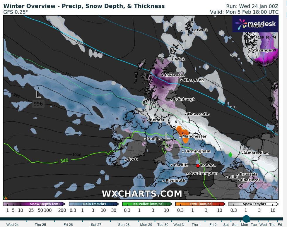
More flurries are expected to blanket Manchester, south east England and Northern Ireland on February 5
|WXCHARTS
"There is uncertainty in exactly where high pressure will become established but, regardless, this does increases the likelihood of drier conditions.
"There is uncertainty in exactly where high pressure will become established but, regardless, this does increases the likelihood of drier conditions."
Currently there is an increased chance of cold spells across the UK compared to average temperatures for this time of year.
Senior Meteorologist and Social Commentator, Jim Dale told GB News that "winter is not quite finished yet" as "continental air" - dry air near the surface while maritime air masses are moist - is set to dominate in February.