
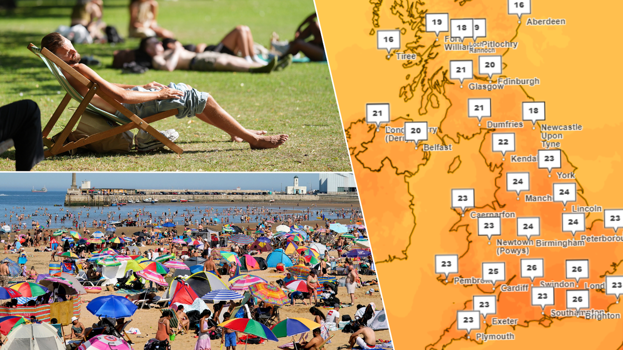


Britain is set to bask in 30C+ heat in just days as an "increasingly hot and humid air mass" bakes the country over the weekend.
Temperatures are set to reach up to 33C in the capital - while the rest of England and Wales can look forward to positively balmy climes, with thermometers averaging high 20s and low 30s across Saturday and Sunday.
Around the UK, Met Office forecasts have circled Sunday and Monday as the hottest couple of days to come, with Manchester, Glasgow and Belfast heading for highs of 26C, 22C and 21C respectively.
And London's stonking 33C temperatures are set to top those in the Sahara Desert - early on Monday afternoon, the capital will edge out 29C Dakhla in the contested territory of Western Sahara on the continent's west coast.
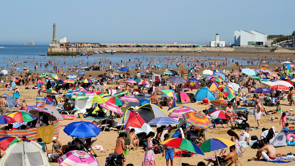
Britain is set to bask in 30C+ heat in just days
|PA
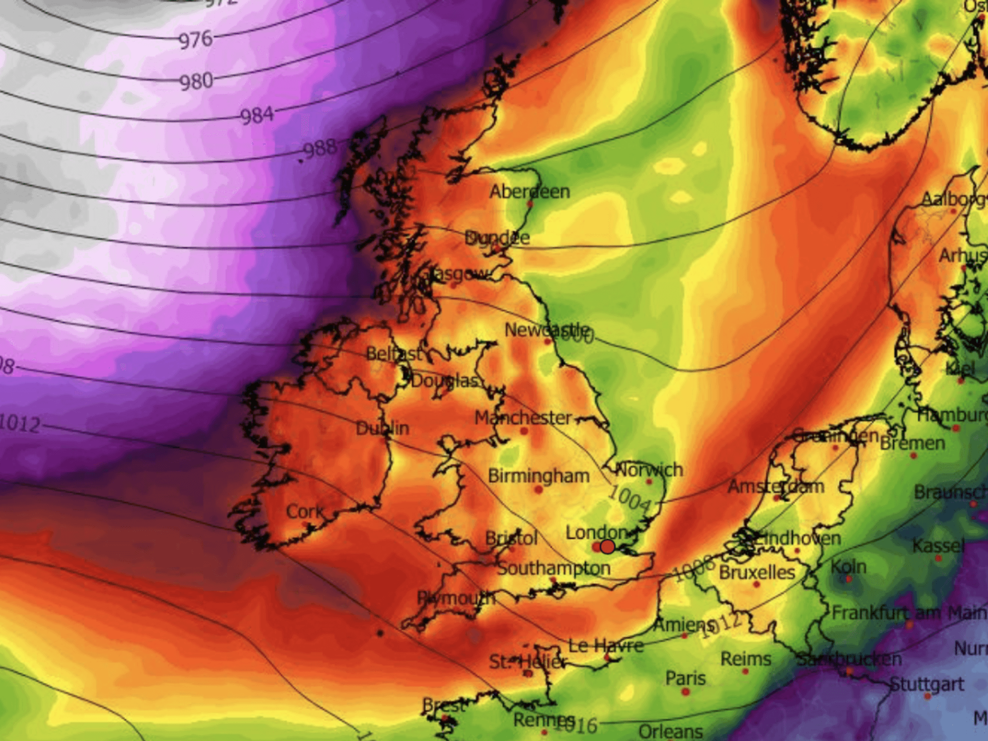
The Monday warmth could see 2024's hottest day record smashed, when Heathrow Airport and Kew Gardens sweltered in 32C heat.
With scorching temperatures expected across the UK, bookies have slashed odds from 4/1 to just 2/1 on the hottest day of the year being recorded this weekend.
Ladbrokes' Alex Apati said: "It's looking increasingly likely that this month will enter the record books for all the right reasons."
But hay fever and sunburn sufferers should be wary, with a hot dry spell falling alongside increased pollen and UV levels across the land.
LATEST WEATHER NEWS:

Bookies said this month could "enter the record books"
|PA
Tropical Storm Debby, which is currently making its way across North America, could contribute to the heat.
Debby is "helping to strengthen the jet stream", according to Met Office chief meteorologist Dan Suri, who added that its slow progress across the Atlantic "will allow hot air to move into the UK later this weekend, and early next week".
Suri added: "Further north and west within this warm air, outbreaks of heavy showers or thunderstorms are possible.
"As well as the hot daytime temperatures, a very warm night is also expected on Sunday night into Monday.
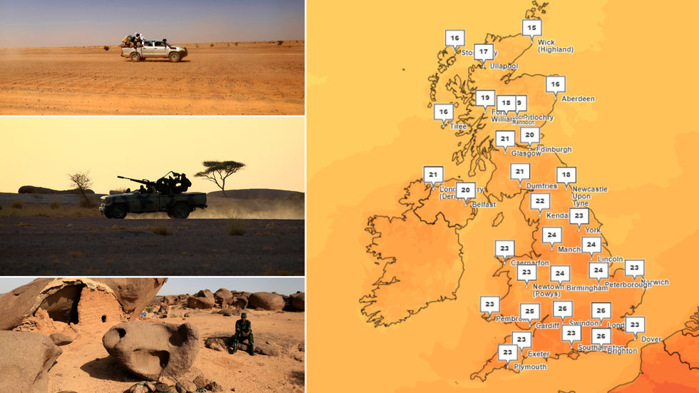
London's stonking 33C temperatures are set to top those in Western Sahara
|Reuters
But Met Office spokeswoman Nicky Maxey has said things may not last, counselling against expectations of a heatwave - which requires three consecutive days above a certain temperature threshold to meet naming criteria.
She said: "The hot spell is short-lived but quite intense... Temperatures are due to peak on Monday and rapidly return to average on Tuesday and Wednesday."
And immediate Met Office forecasts detail how by Tuesday, the hot air mass will likely become displaced by fresher conditions.
Forecasters said the weather then will become unsettled once again, with occasional Atlantic frontal systems or showers moving through at times - but added that things will "feel fairly pleasant in between these systems".