
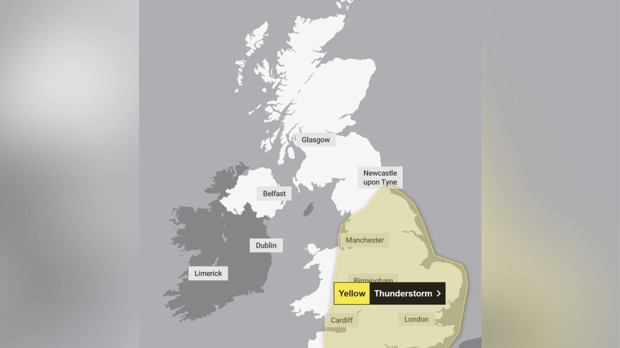


The Met Office has issued a yellow weather warning for thunderstorms.
England and most of Wales are expected to be hit by the warning as heavy rain could pose a "danger to life".
The warning is in place from midday on Thursday and will last into the early hours of Friday morning.
The full list of areas affected is: Wales, east Midlands, southwest England, east of England, London & southeast England, northwest England, Yorkshire & Humber, west Midlands and northeast England.
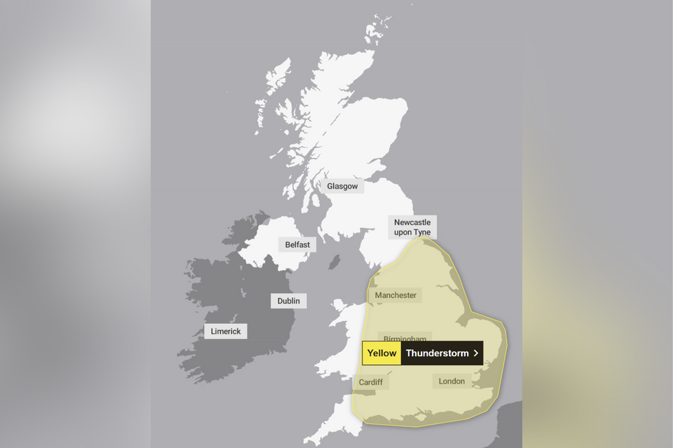
A weather warning has been issued
|Met Office
The alert issued by the Met Office reads: "Heavy showers and thunderstorms are likely to break out across parts of England and Wales on Thursday afternoon. The exact location of showers is still uncertain and some places will stay dry all day.
"However, where the showers do occur they could be torrential, with the additional hazards of lightning, hail and gusty winds...spray and sudden flooding could lead to difficult driving conditions and some road closures".
The warning adds: "Where flooding or lightning strikes occur, there is a chance of delays and some cancellations to train and bus services.
"There is a slight chance that power cuts could occur and other services to some homes and businesses could be lost."
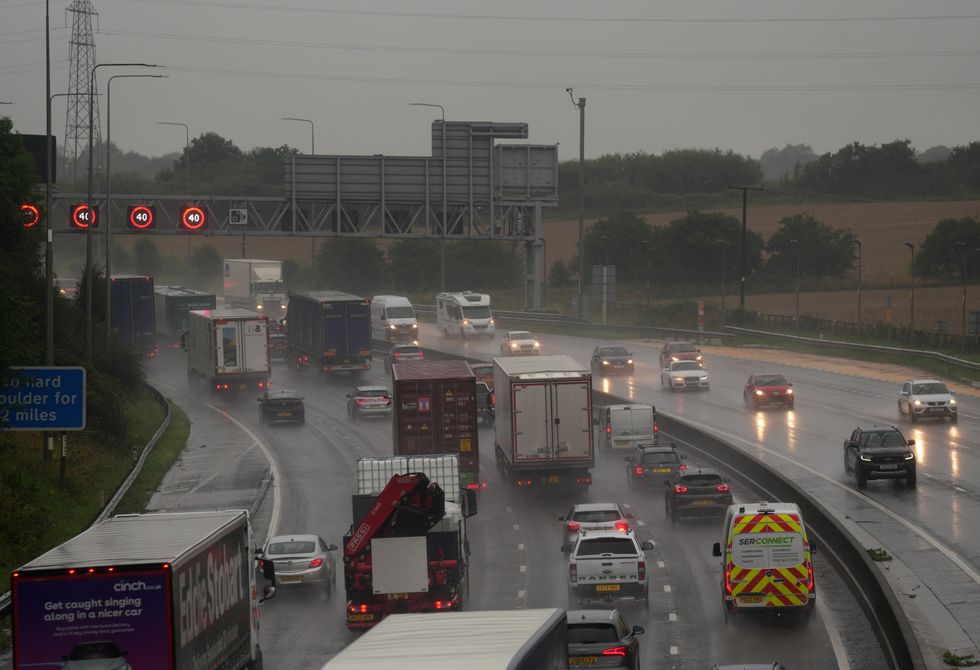
The Met Office has warned of some possible travel disruption (file pic)
|PA
There is a small possibility that fast-flowing, deep floodwater could cause "danger to life", while homes and businesses could be flooded, with some buildings at risk of damage from floodwater, lightning strikes, hail or strong winds.
Met Office forecaster Simon Partridge added said: "Usually you get these thunderstorms come through and then everything's a lot cooler and fresher, but although it will be a bit fresher at the end of the week, it will still be about where we should be, if not a degree or so warmer. So a bit of summer is on the cards."
Looking into the end of the week, the current forecast from the Met Office said: "Mostly fine in the north on Wednesday. [There will be] sunshine further south, but an increasing chance of thundery rain.
"This is clearing eastwards on Thursday. [It will be] fresher with sunshine and showers on Friday."
The Met Office currently predicts north-western areas will probably experience rather breezy conditions with cloud and some outbreaks of rain or drizzle as weakening Atlantic frontal systems push eastwards across the UK.
Toward the south and east, it is set to be drier and brighter much of the time, although there is also the small possibility of some thundery showers spreading in from the nearby continent.