Met Office weather warnings: UK on flood alert as ferocious winds and torrential rain to lash Britain

Britain is set to be battered with torrential downpours and gale force winds as flood alerts have been issued across the UK
|Net Weather

The Met Office has issued two days of yellow weather warnings
Don't Miss
Most Read
Britain is set to be battered with torrential downpours and gale force winds, with warnings of flooding issued across the UK.
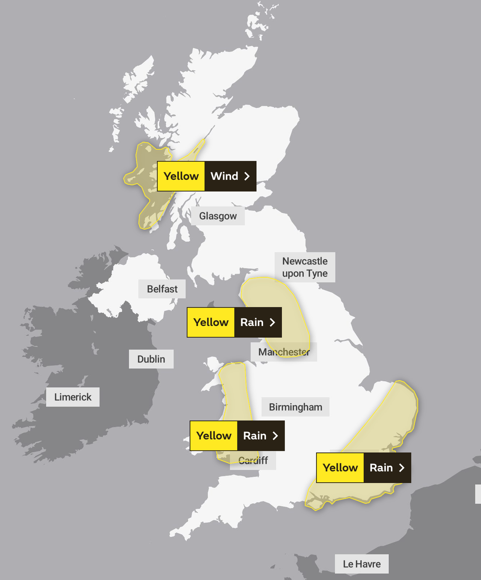
The Met Office has issued a two day weather warning for parts of Britain which will stay in place until Thursday at 3am.
It comes after thunderstorms brought devastating flash floods across areas in Devon and Somerset.
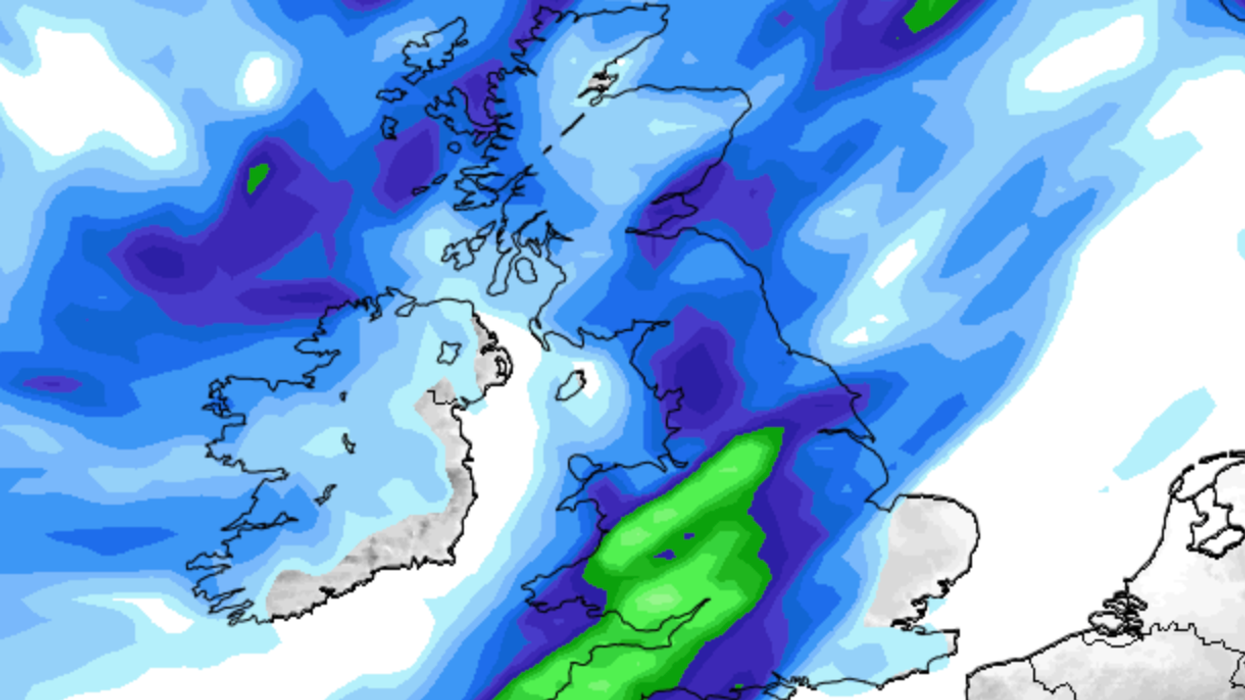
More heavy rain is expected to pour down on north west and south east England as well as Wales on Wednesday afternoon and into the early hours of Thursday

The Met Office has issued a two day weather warning for parts of Britain which will stay in place until Thursday at 3am
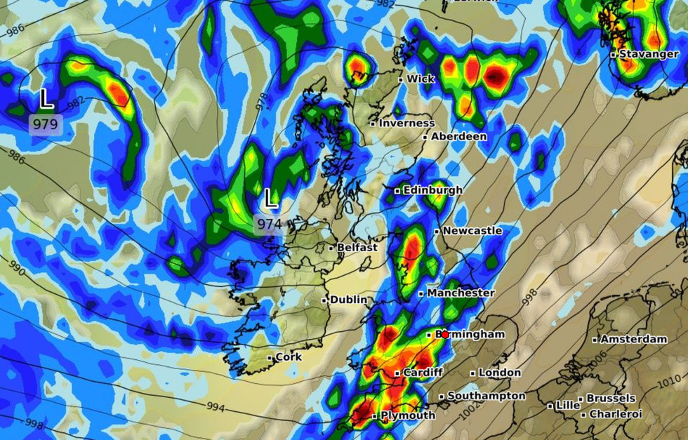
|WXCHARTS
Forecasters suggest the flooding of homes and businesses is likely, and that bus and train services could be impacted.
A Met Office spokesperson said: "A spell of rain, heavy at times, will affect the area later Wednesday afternoon and into the early hours of Thursday.
"15 to 20 mm could fall within an hour in places with as much as 30 to 40 mm over 2 to 3 hours. This may lead to some travel disruption, especially during the busy evening travel period."
Met Office meteorologist Jonathan Vautrey said more storms are possible as the remnants of Hurricane Lee and Hurricane Nigel hit the UK.
LATEST DEVELOPMENTS:
The expert said it will no longer be a hurricane by the time it reaches Britain but will still bring unsettled conditions.
Vautrey said: “That will be getting picked up by the jet stream. Showers in places could be heavy with a risk of further thunderstorms. It could be quite an unsettled, autumnal week to come.”
An extratropical cyclone is set to strike the UK this weekend following the hurricanes.
Hurricane Nigel, which formed in the Atlantic late on Saturday, has intensified into a Category 1 hurricane early on Monday.

Forecasters suggest the flooding of homes and businesses is likely, and that bus and train services could be impacted
|MetOffice
But after the damp weather, the UK will be blasted with warmer temperatures early next week as high pressure brings drier conditions.
Founder and Senior Meteorological Consultant at British Weather Services, Jim Dale told GB News: "Currently there are sustained winds of around 70mph in the mid Atlantic and the course of it is not expected to make landfall.
"By the weekend it was have passed the jet stream and will push through Ireland and will bring characteristics of a normal storm such as strong winds and heavy rain.
"The storm will likely impact the North West England and Scotland the worst, this is where it will be felt most.
"The majority of the UK will see the remnants of the hurricane but it won't be as significant."


