‘Explosive’ Christmas ‘weather bomb’ to bring 80mph gales, rain and snow

Warnings are in force across Scotland
Don't Miss
Most Read
An ‘explosive’ nightmare-before-Christmas ‘weather-bomb’ will hammer Britain with 80mph gales, rain and snow.
Powerful jet stream winds this weekend will steer a deep and stormy area of low pressure towards the UK.
It will blow up under ‘explosive cyclogenesis’, unleashing strong winds and rain to the north on Saturday and then more widely.
Government warnings are in force across Scotland for power outages, coastal flooding and pre-Christmas travel chaos.
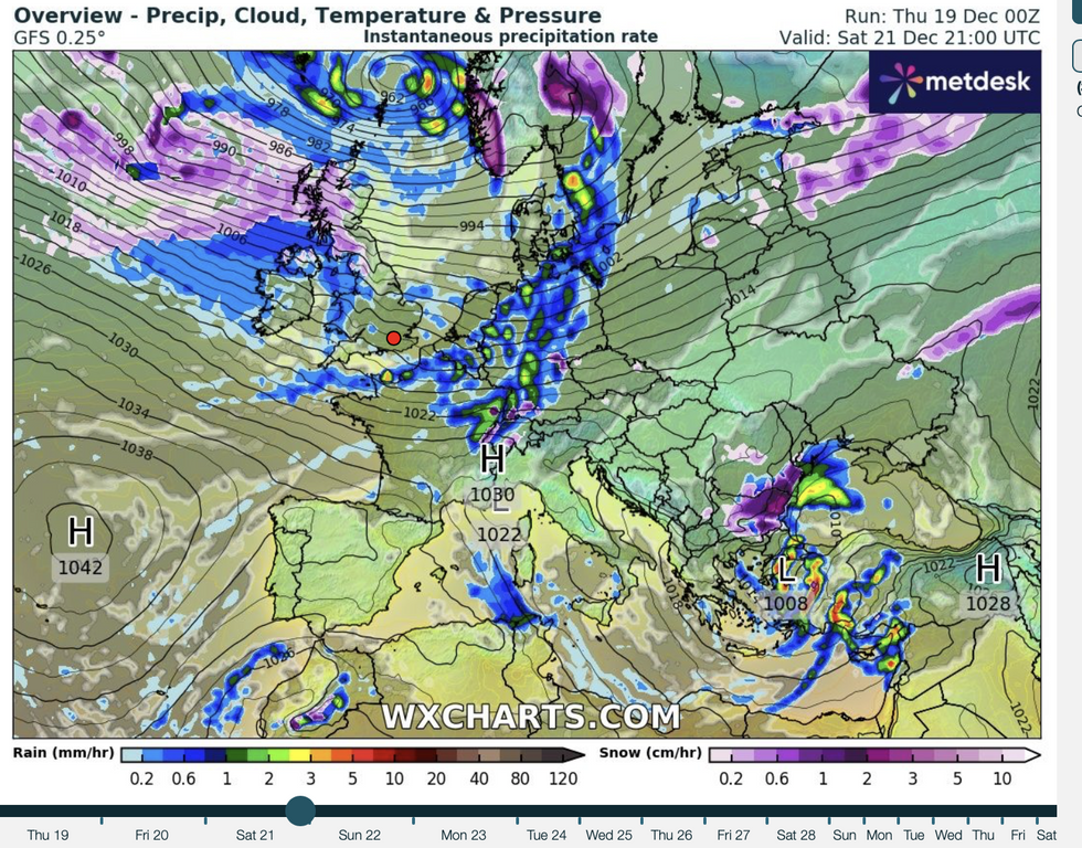
Britain braces for another storm
| WX chartsMet Office meteorologist Alex Burkill said: “A strong jet is going to drive an area of low pressure that is going to go through something called explosive cyclogenesis.
“It is going to deepen rapidly as it heads towards the UK, and confidence on the track of this low is relatively high and there is a good chance that it will track to the north of the UK this weekend.
“We are expecting some very windy weather across northern parts particularly on Saturday and then becoming more widespread on Sunday.”
The storm will pull a plume of cold air in from the north sending temperatures into freefall and triggering snow.
LATEST DEVELOPMENTS: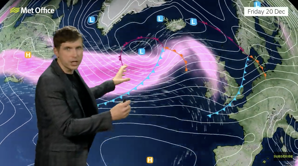
Met Office’s Alex Burkill warns of strong jet stream
|Met Office
Gusts in exposed regions could hit 80mph, Burkill warned, driving ‘convective’ pulses of rain.
He said: “Gusts could reach 70 or 80mph in the most exposed spots, and we could see some very strong gusts, but what is more likely is that we will see some strong gusts across northern parts but on Sunday it is more likely to be windy more widely for most of us.
“There is more cold air waiting and so as we go through the second half of the weekend, as the low pushes eastwards we will see the cold air pushing in, and so Sunday will be a bit chillier for some of us and with that there is a greater chance of seeing some wintry hazards.
“On Sunday, with those lower temperatures, there is a greater chance of us seeing some sleet or snow.”
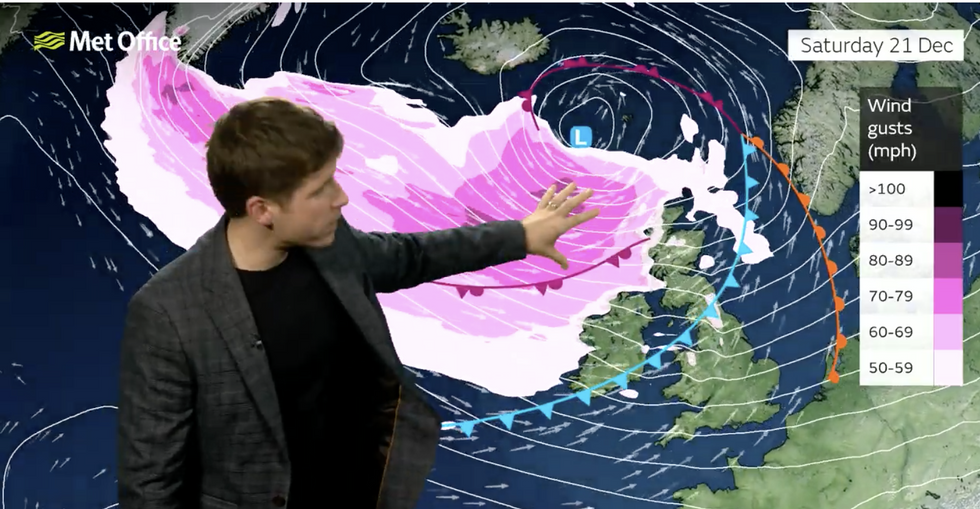
Alex Burkill warns of strong jet stream
|Met Office
As the big day approaches, however, it is all change with high pressure sweeping from the south to keep storms at bay.
Christmas Day, Boxing Day and the end of 2024 promise a calmer picture, Burkill added.
He said: “It is more likely that we see high pressure dominating as we go through Christmas Day and more so by Boxing Day and thereafter, so a more settled spell from Christmas Day onwards.”
The last few days of 2024 will follow the same stormy pattern that has blighted Britain through the past months.
The UK has been hit by four named storms, some of which have strengthened quickly through explosive cyclogenesis.
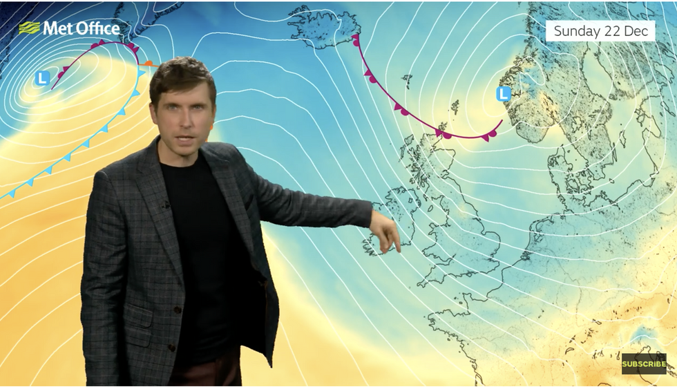
As colder air comes down from the north
|Met Office
The process, which sees sea-level pressure at the storm’s centre drop 24 millibars in 24 hours gives rise to a strong storm known as a ‘weather bomb’.
High pressure, however, will put a lid on the autumnal hammering, bringing a calmer start to 2025.
Jim Dale, meteorologist for British Weather Services and social commentator, said: “The Azores High is building from the south and it is how it interacts with lows coming into the country that will determine the weather.
“The weather will be changeable in the run-up to Christmas, with colder air over some of us that could bring wintry showers.
“However, a proper White Christmas is now very unlikely.”


