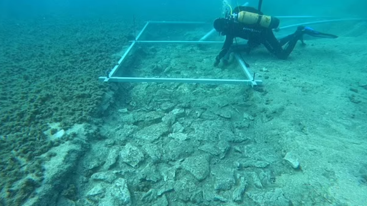
Archaeologists make 'astonishing' discovery about 7,000-year-old sunken city

Archaeologists make 'astonishing' discovery about 7,000-year-old sunken city
|University of Zadar

The ancient city - known as Soline - began to sink around 12,000 BC after sea levels rose following the last Ice Age
Don't Miss
Most Read
Archaeologists have uncovered a “beautifully preserved” 7,000-year-old sunken city in an “astonishing” discovery.
The ancient city - known as Soline - was built by the ancient Hvar culture on an artificial landmass and is submerged off the coast of present-day Croatia.
Soline, which has been preserved under the Adriatic Sea, began to sink around 12,000 BC after sea levels rose following the last Ice Age.
Led by geo-archaeologist Dr Simon Fitch, a team of international researchers used cutting-edge underwater 3D seismic sensors to map this forgotten world, first visiting the area in March 2023.
 Archaeologists make 'astonishing' discovery about 7,000-year-old sunken city | University of Zadar
They hope to use this “astonishing” drowned geography to aid them in further hunts and explorations into Hvar’s other submerged sites and artefacts.
“It's a more diverse landscape and it's better preserved than we expected,” said Fitch, who teaches at the University of Bradford.
“The results,” he said, “provided way more detail than we were expecting.”
He said that their initial findings revealed a world that was likely bustling with human activity.
LATEST DEVELOPMENTS:

The team hope to use this 'astonishing' drowned geography to aid them in further hunts and explorations into Hvar’s other submerged sites and artefacts
|University of Zadar
“That’s amazing because it suggests it is more likely that people lived there,” he explained.
The Adriatic, which divides Croatia from Italy, was once a trade route that connected to the larger Mediterranean Sea. Explorations into its water have uncovered a 2,200-year-old shipwreck, as well as Roman artefacts.
“Croatia is the gateway to Europe, so if you think about the advance of farming in Europe, it is and always has been a very important landscape,” he said.
“Our ultimate goal is to find human artefacts and having this new understanding of the landscape makes that more likely.”
Fitch and his team have used data donated by the firm Petroleum Geo-Services - which collects 3D geological maps - to map other ancient cities in the past, including charting a lost island in the North Sea, Doggerland, that once sat between Great Britain and the Netherlands.

A team of international researchers used cutting-edge underwater 3D seismic sensors to map Soline
|University of Bradford
However, the new project in the Adriatic is using this technology and applying it directly to geological archaeology for reportedly the first time.
The research should help forge a better understanding of the lives of the ancient people of Hvar, whose lives and culture are shrouded in mystery compared to the much more well-known Greeks and Romans.
It may also help scientists learn about how a past human civilization coped with the rising sea levels linked to climate change.
“The speed at which that landscape was lost to the sea is also important,' Dr Fitch said. 'It affected people and culture.”
“So by understanding the landscape, we can begin to understand the whole archaeological picture so much more clearly.”


